



Drone Mapping & Surveying
Highly Accurate Data
Provides high-precision geographic data with centimeter-level accuracy
Fast Turnaround
One of the standout benefits of using drone technology for mapping and surveying is the fast turnaround time.
Cost-Effective
Reduces the need for costly equipment and manual labor
Real-Time Mapping
Real-time mapping with drones offers a significant advantage for industries that need immediate, up-to-date insights into a site’s conditions.
Detailed Description and Sell Points
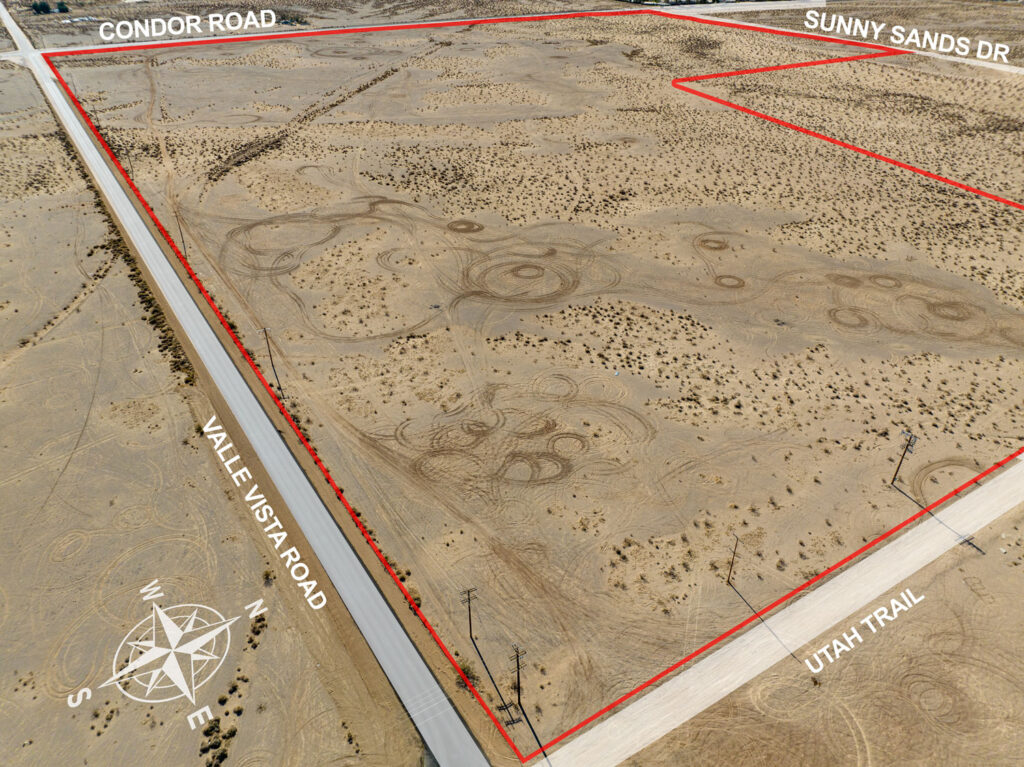
Drone Mapping & Surveying revolutionizes how we collect geographic and topographic data. Equipped with high-precision cameras and LiDAR sensors, drones fly over sites to gather detailed visual and spatial data. The collected data is processed into highly accurate maps, 3D models, or digital terrain models (DTMs) that give clients the ability to visualize and analyze their sites from multiple angles.Industries such as construction, agriculture, mining, and land development benefit greatly from drone mapping services.
Key Sell Points
Fast & Efficient: Gather data quickly, reducing project delays and eliminating the need for extensive fieldwork.
High Accuracy: Our drones provide precise mapping results with a high level of detail that is difficult to achieve with traditional methods.
Advanced Data Processing: We convert collected data into useful formats like orthomosaics, DEMs (digital elevation models), and 3D maps for detailed analysis.
Non-Invasive: Conduct surveys without disturbing the land or environment, ideal for sensitive or active project sites.
Key Data & Metrics
Accuracy: Achieve centimeter-level accuracy with drones equipped with high-definition cameras and LiDAR sensors.
Survey Speed: Complete surveys of up to 100 acres in a single flight, reducing fieldwork time by up to 75%.
Cost Savings: Cut surveying costs by 50-60% compared to traditional methods.
Time Efficiency: Process and analyze survey data within 24-48 hours, compared to weeks with traditional methods.
Key Benefits
Comprehensive Site Mapping: Quickly survey large areas, obtaining accurate data for topographic analysis, land assessments, and more.
Enhanced Project Planning: Make better-informed decisions based on up-to-date, high-resolution data.
Cost Savings: Reduce the need for expensive ground-based surveys and minimize human labor.
Risk Mitigation: Avoid potential errors from manual surveying and improve the accuracy of project designs.
Real-Time Data Access: Get immediate insights into site conditions to accelerate project timelines.
Who Benefits from This Service
Construction Firms: Track progress, plan projects, and monitor land use.
Agricultural Businesses: Assess field conditions, irrigation planning, and crop health.
Mining Operations: Calculate volumes, map mining sites, and monitor resource extraction.
Environmental Scientists: Study ecosystems, detect changes in land use, and monitor environmental impacts.
Urban Planners: Use mapping data for infrastructure planning, zoning, and land development.
Contact Us Today
Take your mapping and surveying projects to the next level with cutting-edge drone technology. Contact us today for a free consultation and see how our Drone Mapping & Surveying services can streamline your workflow and boost your efficiency!